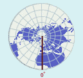
Bestand:Prime Meridian.gif
Prime_Meridian.gif (160 × 150 pixels, bestandsgrootte: 10 kB, MIME-type: image/gif)
Bestandsgeschiedenis
Klik op een datum/tijd om het bestand te zien zoals het destijds was.
| Datum/tijd | Miniatuur | Afmetingen | Gebruiker | Opmerking | |
|---|---|---|---|---|---|
| huidige versie | 13 nov 2010 04:40 |  | 160 × 150 (10 kB) | Adrignola | Cropped. |
| 3 mei 2010 15:47 |  | 160 × 160 (10 kB) | Adrignola | {{Information |Description={{en|1=The prime meridian is a line of longitude that goes north-south through Greenwich, England.}} |Source=http://www.nationalatlas.gov/articles/mapping/IMAGES/latlong4.gif |Author=w:National Atlas of the United States |D |
Bestandsgebruik
Dit bestand wordt op de volgende pagina gebruikt:
Globaal bestandsgebruik
De volgende andere wiki's gebruiken dit bestand:
- Gebruikt op en.wikibooks.org
- Gebruikt op nl.wikipedia.org

