Bestand:Indochina map 1886.jpg

Oorspronkelijk bestand (1.626 × 2.114 pixels, bestandsgrootte: 533 kB, MIME-type: image/jpeg)
| Dit is een bestand van Wikimedia Commons. Onderstaande beschrijving komt van de beschrijving van het bestand daar. Controleer het gebruik van dit bestand in andere Wikimediaprojecten. |
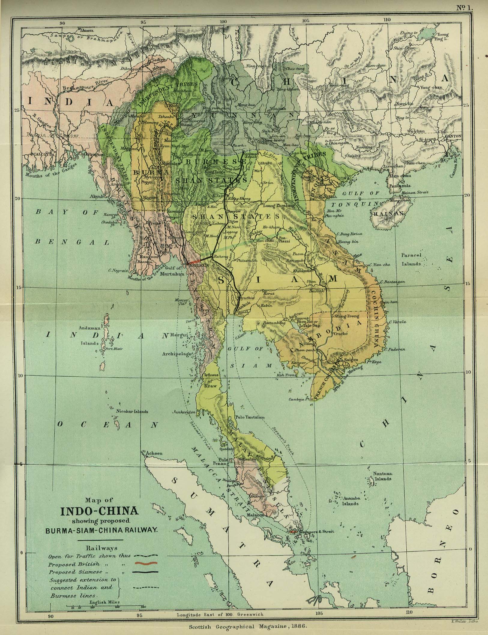
| Beschrijving | Map of Indochina | ||||
| Datum | |||||
| Bron | http://www.lib.utexas.edu/maps/cambodia.html (http://www.lib.utexas.edu/maps/historical/indo_china_1886.jpg); Scottish Geographical Magazine (Volume II) | ||||
| Auteur | Scottish Geographical Magazine and edited by Hugh A. Webster and Arthur Silva White | ||||
| Toestemming (Hergebruik van dit bestand) |
|
||||
| Andere versies | File:IndoChina1886.jpg | ||||
Bestandsgeschiedenis
Klik op een datum/tijd om het bestand te zien zoals het destijds was.
| Datum/tijd | Miniatuur | Afmetingen | Gebruiker | Opmerking | |
|---|---|---|---|---|---|
| huidige versie | 2 mei 2008 04:56 | | 1.626 × 2.114 (533 kB) | Calliopejen1 | {{Information |Description=Map of French Indochina |Source=http://www.lib.utexas.edu/maps/cambodia.html (http://www.lib.utexas.edu/maps/historical/indo_china_1886.jpg) |Date=1886 |Author=Scottish Geographical Magazine |Permission={{PD-old}} |other_version |
Bestandsgebruik
Geen enkele pagina gebruikt dit bestand.
Globaal bestandsgebruik
De volgende andere wiki's gebruiken dit bestand:
- Gebruikt op bcl.wikipedia.org
- Gebruikt op el.wikipedia.org
- Gebruikt op en.wikipedia.org
- Gebruikt op en.wikiversity.org
- Gebruikt op fi.wikipedia.org
- Gebruikt op got.wikipedia.org
- Gebruikt op kn.wikipedia.org
- Gebruikt op ms.wikipedia.org
- Gebruikt op pa.wikipedia.org
- Gebruikt op sl.wikipedia.org
- Gebruikt op uz.wikipedia.org