Bestand:Europe bluemarble laea location map.jpg

Grootte van deze voorvertoning: 701 × 599 pixels. Andere resoluties: 281 × 240 pixels | 561 × 480 pixels | 898 × 768 pixels | 1.198 × 1.024 pixels | 1.400 × 1.197 pixels.
Oorspronkelijk bestand (1.400 × 1.197 pixels, bestandsgrootte: 926 kB, MIME-type: image/jpeg)
| Dit is een bestand van Wikimedia Commons. Onderstaande beschrijving komt van de beschrijving van het bestand daar. Controleer het gebruik van dit bestand in andere Wikimediaprojecten. |
World war 1
Beschrijving
| Beschrijving |
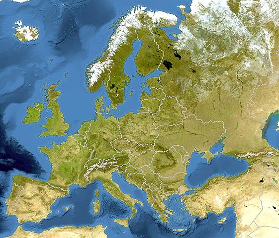
Deutsch: Bluemarble Positionskarte Europa; Flächentreue Azimutalprojektion
English: Bluemarble Location map Europe; Lambert azimuthal equal-area projection
|
| Datum | |
| Bron |
Eigen werk
|
| Auteur | Alexrk2 |
| Andere versies |
[]
|


.svg)


|
Deze kaart is gemaakt of verbeterd in de Duitse Kartenwerkstatt (Map Lab). Je kunt ook zelf kaarten ter verbetering voorstellen.
|
Licentie
Ik, de auteursrechthebbende van dit werk, maak het hierbij onder de volgende licentie beschikbaar:
Dit bestand is gelicenseerd onder de Creative Commons-licentie Naamsvermelding-Gelijk delen 3.0 Unported
- De gebruiker mag:
- Delen – het werk kopiëren, verspreiden en doorgeven
- Remixen – afgeleide werken maken
- Onder de volgende voorwaarden:
- naamsvermelding – U moet op een gepaste manier aan naamsvermelding doen, een link naar de licentie geven, en aangeven of er wijzigingen in het werk zijn aangebracht. U mag dit op elke redelijke manier doen, maar niet zodanig dat de indruk wordt gewekt dat de licentiegever instemt met uw werk of uw gebruik van zijn werk.
- Gelijk delen – Als u het werk heeft geremixt, veranderd, of erop heeft voortgebouwd, moet u het gewijzigde materiaal verspreiden onder dezelfde licentie als het oorspronkelijke werk, of een daarmee compatibele licentie.
Bestandsgeschiedenis
Klik op een datum/tijd om het bestand te zien zoals het destijds was.
| Datum/tijd | Miniatuur | Afmetingen | Gebruiker | Opmerking | |
|---|---|---|---|---|---|
| huidige versie | 13 mrt 2010 15:52 | | 1.400 × 1.197 (926 kB) | Alexrk2 | == Summary == {{Information |Description= {{de|Bluemarble Positionskarte Europa; Flächentreue Azimutalprojektion}} {{en|Bluemarble Location map Europe; Lambert azimuthal equal-area projection}} * Projection: LAEA Europe, [ht |
Bestandsgebruik
Dit bestand wordt op de volgende pagina gebruikt:
Globaal bestandsgebruik
De volgende andere wiki's gebruiken dit bestand:
- Gebruikt op af.wiktionary.org
- Gebruikt op als.wikipedia.org
- Gebruikt op av.wikipedia.org
- Gebruikt op az.wikipedia.org
- Gebruikt op ce.wikipedia.org
- Gebruikt op de.wikipedia.org
- Gebruikt op dsb.wikipedia.org
- Gebruikt op eo.wikipedia.org
- Gebruikt op frr.wikipedia.org
- Gebruikt op fr.wikipedia.org
- Gebruikt op fr.wikinews.org
- Gebruikt op hsb.wikipedia.org
- Gebruikt op hu.wiktionary.org
- Gebruikt op inh.wikipedia.org
- Gebruikt op kaa.wikipedia.org
- Gebruikt op kk.wikipedia.org
- Gebruikt op lv.wikipedia.org
- Gebruikt op mn.wikipedia.org
- Gebruikt op nds-nl.wikipedia.org
- Gebruikt op pt.wikipedia.org
- Gebruikt op ru.wikipedia.org
- Gebruikt op tg.wikipedia.org
- Gebruikt op tt.wikipedia.org
- Gebruikt op uk.wikipedia.org