Bestand:Aj-map.png
Geen hogere resolutie beschikbaar.
Aj-map.png (325 × 349 pixels, bestandsgrootte: 13 kB, MIME-type: image/png)
| Dit is een bestand van Wikimedia Commons. Onderstaande beschrijving komt van de beschrijving van het bestand daar. Controleer het gebruik van dit bestand in andere Wikimediaprojecten. |
Beschrijving
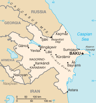
| Beschrijving |
Türkçe: Azerbaycan'ın CIA tarafından oluşturulmuş haritası |
| Datum | |
| Bron | CIA World Factbook |
| Auteur | United States Central Intelligence Agency |
Licentie
Deze afbeelding bevindt zich in het publiek domein omdat het materiaal bevat dat oorspronkelijk afkomstig is van het CIA World Factbook.
|
 |
Derivative works
Afgeleide werken van dit bestand: Mapa de Azerbaiyán.png
| Aantekeningen | Deze afbeelding is aangetekend: Bekijk de aantekeningen op Commons |
Bestandsgeschiedenis
Klik op een datum/tijd om het bestand te zien zoals het destijds was.
| Datum/tijd | Miniatuur | Afmetingen | Gebruiker | Opmerking | |
|---|---|---|---|---|---|
| huidige versie | 19 feb 2022 09:44 | | 325 × 349 (13 kB) | Lojwe | Cropped 1 % horizontally, 1 % vertically using CropTool with precise mode. |
| 5 aug 2015 14:44 |  | 328 × 352 (14 kB) | Ray Garraty | Reverted to version as of 22:26, 26 February 2005 | |
| 5 aug 2015 14:11 |  | 328 × 352 (43 kB) | Szczureq | Added border of Armenian-controlled Nagorno-Karabakh territory | |
| 27 feb 2005 00:26 |  | 328 × 352 (14 kB) | Alfio | Cia map of Azerbaijan |
Bestandsgebruik
Dit bestand wordt op de volgende pagina gebruikt:
Globaal bestandsgebruik
De volgende andere wiki's gebruiken dit bestand:
- Gebruikt op ab.wikipedia.org
- Gebruikt op af.wikipedia.org
- Gebruikt op ast.wikipedia.org
- Gebruikt op av.wikipedia.org
- Gebruikt op azb.wikipedia.org
- Gebruikt op az.wikipedia.org
- Gebruikt op be-tarask.wikipedia.org
- Gebruikt op be.wikipedia.org
- Gebruikt op bg.wikipedia.org
- Gebruikt op bg.wiktionary.org
- Gebruikt op br.wikipedia.org
- Gebruikt op bs.wikipedia.org
- Gebruikt op ca.wikipedia.org
- Gebruikt op cs.wikipedia.org
- Gebruikt op cv.wikipedia.org
- Gebruikt op da.wikipedia.org
- Gebruikt op de.wikipedia.org
- Gebruikt op dsb.wikipedia.org
- Gebruikt op el.wikipedia.org
- Gebruikt op en.wikipedia.org
- Branobel
- SOCAR
- Dunsterforce
- Shah Deniz gas field
- Portal:Azerbaijan
- Portal:Azerbaijan/Azerbaijan-related topics
- Azeri–Chirag–Gunashli
- Extreme points of Azerbaijan
- Azerbaijan International Operating Company
- List of airports in Azerbaijan
- Darwin Bank
- Energy in Azerbaijan
- Karabakh oilfield
- Caspian International Petroleum Company
- Chirag oilfield
Globaal gebruik van dit bestand bekijken.